
ConvertGeodeticDatum
Extension Delisted
This extension is no longer available in the official store. Delisted on 2025-09-16.
Extension Actions
- Live on Store
Display Google Map after modify Geodetic Datum
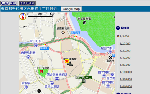
Press the "Google Map" button added behind the address to display the same location on Google Map.
I felt that the map displayed in the "vehicle position at detection" of "engine start notification mail" which is one of the functions by Toyota's car navigation T-Connect (G-BOOK) is not easy to use.
So add the button to open the currently open location on Google Map on the map of T - Connect.
Since the position of the GPS of the car navigation includes about 10m error.
But, you may not find the errors on the T-Connect map, because the map is small. The other hand Google Map can also display scales smaller. So, you may feel there are position errors on Google Map.
Since car navigation GPS seems to be using the old Japan geodetic system (Tokyo Datum), this extension use Proj4js to convert it to the world geodetic system (WGS84) which Google map maybe using.
From now on, we plan to extend the range of correspondence not only to the map of T - Connect but also to other maps.
What's New!
0.9 Initial release